Me and a friend who has rebuilt his GIS stack and datasets for making agriluture apps to many times set out to make it so we never had to do it agani.
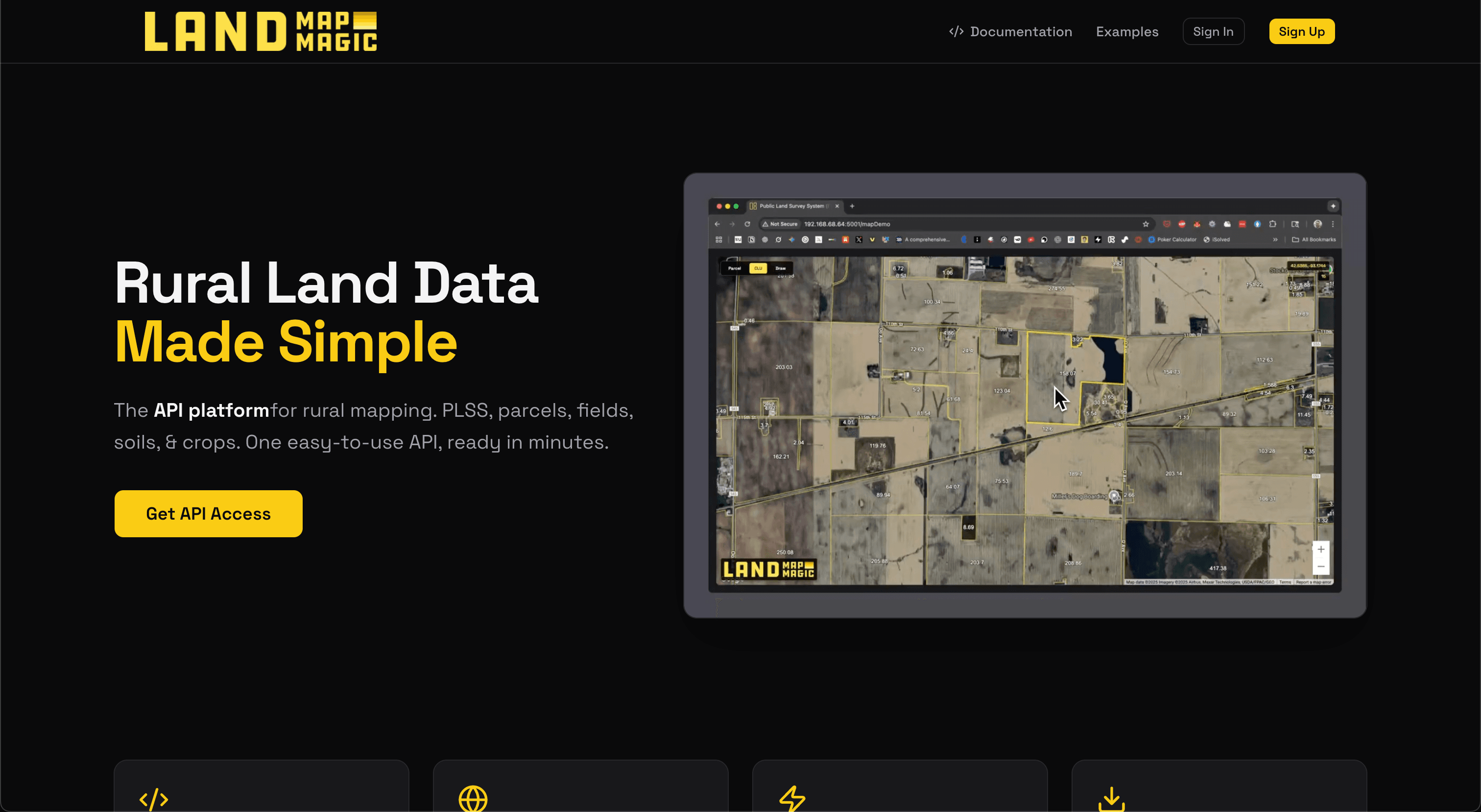
The solution is a API that provides tile serving for common agricluture data like CLU ( USA Field Boundaries from Gov ), CDL ( SUA Cropping Data Layer from Gov for last 20 yers), SSURGO ( Soil Maps ), Parcels ( Land Ownerhsihp ) etc into a simple one line experience vs a 6 month roadmap.
We also included the helpers you need like AOI ( area of interest ) queries that let you draw a polygon and fetch each layers details, and place and point searhc.
Leaning hard also into what makes a good api surface area, deployment target and docs so Ai Agents can help people build these.